Information

Information

ALANYA

Alanya offers numerous options for tourists who choose to spend their holidays at this resort. The town presents a history dating back to thousands of years, a culture combining the Mediterranean and Anatolian values and a distinct architecture. Besides the beautiful beaches of over 100 km, the town offers other alternatives including historical places of interest, a picturesque nature and heavenly plateaus of Taurus Mountains. Western Taurus Mountains rise just beyond the Mediterranean Sea which turns from blue to turquoise color towards Alanya... Taurus Mountains create an utterly different world with their pine and cedar forests, plateaus and the rivers running down from the upper reaches. In April, the town smells like it is washed with perfume when the orange trees blossom; roadsides are covered with colorful flowers throughout all seasons. There are many caves on land and in sea which are fascinating, mystical and therapeutic... And the sun... it is life. Alanya is the place where the sun smiles.
The sandy beaches in Alanya are credited with Blue Flag; the international symbol of the clean waters. The fish in the depths of the water is visible even to the naked eye during calm weather in this unique part of the Mediterranean coast where the sea turns to turquoise color along the shore.
Alanya has a typical Mediterranean climate. The characteristics of this climate are rainy and humid winters, and dry and hot summers. The town is protected against the wind from three directions where high mountains rise to the East, North and West, enabling most types of plants to be grown in the region.

Greenhouse cultivation is widely practiced in Alanya and the surrounding areas. Farmers in Alanya are able to grow the vegetables and fruits which normally would not grow during harsh winter, and distribute them across Turkey. Bananas are also an important source of revenue besides the out-of-season vegetables. Alanya banana is in itself a nationwide brand.

History
Alanya is built on a small peninsula bordered by the Taurus Mountains to the North and the Mediterranean Sea to the South. During ancient times, it has also been referred to as either Pamphylia or Cilicia due to its location on the borders of these two regions. The skeletons and fossils excavated between Bademağacı and Oba Bay in the northeastern region of the central town indicate that the history of Alanya dates back to the 'Upper Palaeolithic Era' (20,000 - 17,000 BC) which is regarded as the 'Dark Ages'.

There isn’t much information on the region dating back to the first ages and the Byzantium period. According to famous historian Herodotus, the local tribes hosted those who came and settled here after the Trojan War in 1820 BC. Hittites arrived at this land, killed 600 people and took Pamphylia and Cilicia under their governance. Cilicia managed to remain independent during the invasion by Antiochus the Great, due to the challenges he faced to siege and take the Collesium.

During the Arab raid in the 7th century AC, the protection of the town became more important and building castles became a priority. This is why most of the castles and churches in and around Alanya date back to 6th and 7th centuries AC. The oldest name of the town in records is Coracesium. It has been renamed as Kolonoros during the Byzantium times.
The Anatolian Seljuk Sultan Alaeddin Kayqubad I (1200-1237) invaded the castle when he defeated the Christian dynasty Kyr Vart in 1221, who had been reigning the region. The sultan, who married the daughter of Kyr Vart, had a palace built in the town which he later renamed Alaiye. Seljuks made many public improvements in the town which they used as a winter residence and second capital after the city of Konya. The town went through its peak period during the reign of Alaeddin Kayqubad. Majority of the castles, shipyards and surviving buildings date back to this period.

In 1300, the town went under the domination of Karamanids after the Anatolian Seljuks fell apart. Based in Konya, Karamanids sold the town to the Egyptian Mameluke Empire for 5,000 gold coins in 1427.

Finally in 1471, Alaiye was re-invaded and included to the Ottoman Empire by Gedik Ahmed Pasha -one of the commanders of Mehmed the Conqueror- after the uniformity was secured in Anatolia and Ottoman Beylics became prominent.

During the Ottoman Empire, Alaiye was first designated as part of the Cyprus province (1571) and then the district of city of Konya (1864). Re-designated as part of Antalya province in 1868, Alaiye became a district of Antalya in 1871. During a visit in 1935, Atatürk revised the town’s name as Alanya.


GAZİPAŞA

It is built on a 7 km wide and 10 km long Gazipaşa lowland on the Mediterranean coast, 180 km east of Antalya. It is adjacent to Anamur district in the province of İçel to the east, Ermenek district of Karaman province to the northeast, Sarıveliler to the north and Alanya to the west. It stands on a narrow strip of coast between the Mediterranean Sea to the south with Taurus Mountains rising behind from west to east parallel to the Mediterranean Sea; 35 km inland. It has a surface area of 931 km, with the town center situated 3 km inland, however; new residential areas are also built between the town center and the coast.
The coast line of the district is approximately 50 km long. There are many suitable beaches to swim. Nearly half of the coast line is sandy beaches whilst the other half is rocky, however, there are spectacular bays hidden between the rocky stretches, which are ideal for swimming. There are low hills between the town center and the coast. There is a mountainous plateau to the north of the lowland. During April and May, it is possible both to ski and swim in the town within an hour distance.
The western mountain range of the Taurus Mountains is known as Akçal Mountains and its highest reach “Deliktaş” is 2253 m. The lower parts form an alluvial lowland along the coast. There are steep slopes between the alluvial lowland and the mountainous part. There are seaside cliffs in front of the southern hill area where Selinus ruins are located. The beaches are on both sides of the hill situated on the coast. The beaches have limestone sandy shores. The cliffs are formed with limestone, which at places reach up to 50-100 m high.
Here, the soil is red chestnut color and suitable for growing vegetables, citrus and bananas. The soil inland is red (Terrarossa) and suitable for grain agriculture. Stock breeding is more common on the highlands.

One of the most important milestones in the history of Gazipaşa dates back to 628 BC. There were two towns in the history with the same name Selinus. One of them is the town built by the Greek Megara-Hyblaia locals in Sicily, and the other one is the town in the south of Anatolia. Gazipaşa (as known today) was a port town built on both sides of the Cilicia region and Hacımusa Stream (Kestros). It was also a port town trading with other centers in the Mediterranean such as Cyprus and Egypt.
When Hittites were defeated by the sea tribes, there was a lack of authority in the region which then entered under the governance of Egypt's 26th dynasty in the 8th century BC. The foundation of KRAGUM (Nohutyeri) was laid during this period. It was governed by Persians between the middle of 7th century until the 4th century. It went under the reign of the Great Iskender (Macedonian King) Alexander who ended the Persian governance over the region. When the Great Iskender died, it was reigned by his successor SELEVKOS. Later, it entered under the governance of COMMAGENE Kingdom based in Adıyaman. Nohutyeri was dedicated to the Commagene King ANTIAKOS IV.
197 BC, it went under Roman governance during the reign of Antiokhos. In the 1st century the Roman King Trajanus (98-117) came to Selinus after falling ill, but he could not recover and died. His successor Hadrianus came to Selinus to take the coffin back to Rome and had a tomb built dedicated to Trajanus. Therefore, Selinus was referred to as Trajanapolis for a while.
Built on the west of Cilicia, Gazipaşa's faith was always depended on Alanya, which is the closest main settlement. The town went through a period dominated by pirates. (Please see other pages for further information). In 65 BC, the Roman commander Pompeius's army defeated the pirates in the region and Selinus became a small Roman settlement.
The Roman Empire Period which started in the 1st century BC dominated the region until the 6th century. It then became an episcopacy center affiliated to Seleukeia-Silifke archbishop during the Christianity period of Roma. It entered under the sovereignty of Southern Mediterranean Byzantium Empire in 6th century.
During the period when Seljuks dominated a large part of the Byzantium land in Anatolia, Sultan Alaeddin Kayqubad I (1220-1237) took Alanya, Gazipaşa and the surrounding areas under his dominance.
During this period, its name changed to "Selinti" probably by Seljuks or after the floods caused by five big streams running from the Taurus Mountains through the town center before they flow into the sea. After Seljuks and during the Anatolian beylics, Antalya and the surrounding areas was reigned by Teke Beylic while Gazipaşa (Selinti) and the eastern and northern areas was reigned by Karamanids Beylic which was based in Konya.
During the Ottoman Period, Mehmed the Conqueror’s commander Gedik Ahmet Pasha (aka Kaptan'ı Derya) took Alanya in 1470 and Selinti (Gazipaşa), Anamur and Silifke region in 1472 from Karamanids Beylic and put them under the Ottoman governance.
The famous explorer Evliya Çelebi wrote in his Itinerary that during the 18th century, Selinti was a district within the borders of Mersin, which had 26 villages which paid 80 akçe (coins) in tax to Silifke Sanjak. It had a well-kept mosque and houses surrounded by green nature. It had a port 70 miles from Cyprus.
Turkish War of Independence and Republic Period
During the Turkish War of Independence, Selinti (Gazipaşa) allied with Mustafa Kemal and nationalistic forces. The nomad tribes (probably the nomads living on Taurus Mountains) played a role in suppressing the uprising (known as Delibaş Uprising) which began around the moorland facing the Central Anatolia side of the Taurus Mountains.
After the proclamation of the republic, the area was officially given the status of ‘district’ on 21st of October 1922 under the name of Gazipaşa. The name Gazipaşa (which is a title of Mustafa Kemal Pasha) was officially given to the district as recognition of the support that the locals provided during the Turkish War of Independence.
In 1926, the official status of 'district' was removed due to the low number of population. The eastern part of Hacı Musa Stream was added to Anamur under the name of Şansa Nahiyesi and the west was affiliated to Alanya under the name of Pazarcı Gazipaşa.
It regained its 'district' status in 1947 with the Grand National Assembly decision no. 5071 and separated from Anamur with Kaladran Stream.
Although Gazipaşa seems to be an agricultural region, it was declared a tourism resort on 13th of September 1989 with a Cabinet decision (89/14499) published on the Official Gazette issue no. 20281, and rapidly adopted itself to the tourism sector especially following the start of the constructions to build an airport and a marina. Currently, the district has a capacity of 600 beds at 2 commercial hotels, 2 touristic hotels (one of which is an apart hotel), bungalows operated by the Gazipaşa Municipality Naval Facilities and 1 resort hotel whilst more hotels and motels are built continuously.
Gazipaşa has more places of interest (ruins) compared to other regions, however almost majority of them lacks or have insufficient access roads and protection.
Gazipaşa is one of the 17 centers where Caretta Caretta turtles lay eggs along the Mediterranean coast.
It has a great potential in respect of tourism, with historical castles and ruins, crystal clear waters and beaches, lush green highlands with plenty of oxygen, in other words, an unspoilt nature.


ANAMUR 

Situated outside the main passages used by the armies and trade convoys in Cilicia during the ancient times, Anamur and the surrounding areas have qualities presenting invaluable and specific information.
Listed under the city of Mersin, it is situated on the Turkish Highway No. 24. It has a surface area of 2005 km. It is located 230 km to Mersin, 138 km to Silifke, 16 km to Bozyazı, 79 km to Gazipaşa, 52 km to Aydıncık and 125 km to Alanya. It borders Gazipaşa/Antalya to the west, Gülnar to the northeast, Ermenek/Karaman to the north and Bozyazı to the east.
It is possible to see the mountains on Cyprus from this unspoilt district which has the longest coast line in Turkey.
Tourists visiting the area are recommended to explore the nature and cultural richness that Anamur offers. The places of interest include Köşekbükü Astım Cave, The Ancient Town of Titiapolis, Mamure Castle, Alaköprü, The Ancient Town of Anamuryum, Plateaus, Pullu Forest Camp Area, Azıtepe, Atatepe, Akcami, the beaches, the pier, Taurus Mountains, Dibek Trout Farms and Abanoz which is one of the largest plateaus along the Mediterranean. The list goes on... Anamur also houses the world's longest doline; Çukurpınar Düden.
The region is also renowned for growing the world's most quality banana type. It is a very distinct banana type with its smell and taste. Anamur bananas are available and sold at every corner at very reasonable prices. Banana is the most valuable and important source of revenue for Anamur. Locals work very hard to be able to distribute the world's most quality banana across the country. With its agricultural potential, Anamur contributes a great deal to the country's economy.
Besides being an agricultural town, Anamur is also a tourism resort. Summer houses, hotels, guest houses and furnished properties rented daily are all ready for the visitors.
The length of the coastline in Anamur, the most far and an important tourism resort of the city of Mersin, is 60 km between Bozyazı border and Anıtlı (Kaledran), without taking all the bays and headlands into account. The skirts of mountains on the east and west coast reach down to the sea level at certain places. Therefore, the sea is mostly quite deep and there are only a few beaches. However, there are natural beaches in Melleç and Anıtlı (Kaledran) areas. There is also a 17 km long beach in the center of Anamur between Pullu National Forest Park and Anamurim (Anamur Headland). Every part of the beach is suitable for swimming.
Beaches in Anamur are equipped with all facilities required from a touristic resort. Ören beach is situated to the west of Anamur. It is a sandy beach with pebbles at certain sections. The sea here is deeper compared to other beaches around. The sea deepens suddenly at 2-3 m into it. The formation of this 17 km natural beach is related to the formation of a lowland between the sea and the Taurus Mountains in the North which stretches parallel to the sea.
The sea water is the most cleanest in Turkey. There is no factory waste going into the sea here. Shores are not yet regulated. Visitors can swim anywhere they prefer. Beach facilities are provided in front of certain centers. The task of creating awareness amongst the locals in improving the beaches, keeping them clean and providing more shower facilities fall to the municipalities in the region. The streams offshore Ören and along the Mediterranean coast also cleans the sea water which filters itself. Kocaçay is one of the streams contributing to this process.
Pullu beach and the other beaches around Kale are also suitable for sun-bathing and swimming. Situated opposite the Castle, Güvercin Island is the home of the sea gulls and an ideal target for good swimmers.
Sandy and pebble beaches along the Anamur coast stand out instantly. The beach at Cerenler between Dragon and Çayağzı is renowned for its shallow water.
Pullu camp area is suitable for tents. It is one of the few places where sea, sand and forest join together. Dragon Park, on the other hand, is suitable for both swimming and picnics under the trees. WC and shower facilities are provided.
There are tea gardens, restaurants, guest houses and hotels on the beaches at the pier area.
The sea season continues in April and November due to the warm sea and weather temperatures on the natural beaches and picturesque bays. The long sea season support the tourism potential in the region.

During hot summer months, locals emigrate to the Taşeli Plateau and highlands on Taurus Mountains. These plateaus are located on Taurus Mountains between the altitude of 1000 and 2000 m which are surrounded by trees, fed by rivers with cooler temperatures and plenty of oxygen.
Today, nomadic transhumance continues to be a source of income for certain people. Vegetables and fruits grown on the highland, dairy products, apiculture, stock breeding and bazaars are still some of the important source of income for the locals.

Anamur Headland was formed from lime stones 570 - 227 million years ago during the Paleozoic Era. Coastal mountains surrounding the lowland were formed during the Permian and carboniferous periods of the Paleozoic Era. Plateaus were also formed at the sections of the mountains facing the sea. The water of this large plateau covering Anamur and Bozyazı is carried to the sea by Dragon "Arymagdus" and Sultan streams in Anamur, Sini Stream in Bozyazı and Anıtlı (Kaladran) Stream in Kalendran.

Anamur was governed by the Kizuvatna Kingdom during Hittites period. This kingdom was also governed by the Hittites from time to time. The settlement entered under the sovereign of Assyrians during the 8th century BC. In 6th century, it was dominated by Persians who arrived at Anatolia. In 333 BC, it went under the governance of the Macedonia Kingdom during the eastern expedition of the Great Iskender. During that period, the town (known as Anemurion at the time) was surrounded by two lines of walls looking like a castle, which survived until today with some renovations carried out from time to time. At that period, the coastal road from Soloi to Aspendos passed through Anemurion. Following the death of the Great Iskender, the settlement initially governed by Selevkos (one of the states established then) before going under the sovereignty of Roman Empire in the 1st century. Roam Emperor Calıgula gave Anemurium to the Commagene Kingdom along with some other coastal towns.
Following the split of the Roman Empire into two, Anamur and the region was taken by the Byzantium. (395 AC) At the Byzantium Period, the Arab riots to Anatolia began during the reign of Abbasi caliph Mansur. (8th century). After that date, Anamur changed hands a few times between Arabs and Byzantium, like many regions in the southern Anatolia. The region went under the governance of the Turks after Seljuks invaded the Anamur Castle. During the weakest period of Seljuks, it was dominated by Karamanids before joining the Ottoman land during the second half of the 15th century.
The origin of the name of Anamur district which dates back to ancient periods is the old name "ANEMORIUM". It is a Latin word and means "Windy Headland". According to historical records, it was governed by Phoenicians, Hittites, Assyrians, Iranians and Romans. After going under Byzantium dominance, it was rebuilt. Seljuk Sultan Alaeddin Kayqubad assigned "ERTOKUS BEY" to invade the coastal towns, who then seized Anamur in 1228. Later, it was governed by Karamanids before joining the Ottoman Empire. The town was given the statuses of first Directorate and then District Governorship in 1859 and 1869 respectively within the Ottoman Administration Body.
The Turkic Tribes settled in Anamur was member of YIVA Tribe. During the Beyazıd II period, YIVA Clan was one of the largest internal organizations. Internal YIVA Tribe was separated smaller and large branches. The records reveal that there were forty member villages to YIVA Tribe during this period.
The endpoints of the mountains coming down through Anamur and Taurus district join the rocky cliffs. There are many settlements on the highlands. During spring, mountains are covered with lilies and many other types of flowers creating a colorful view.
During the months with low humidity, it is possible to watch the silhouette of Cyprus from Anamur.
It is also possible to swim in the sea and then ski on highlands in the same day during winter depending on the weather.
Visitors can swim in the crystal clear waters in Anemurium and then explore the historical ruins, then climb the French lighthouse to watch the spectacular view of the sea.
The 5 m wide running water sourcing from the highland of Sugözü district joins the Dragon Stream before flowing into the sea. It turns red at the sun set creating a mystical lighting effect.
Caretta Caretta turtles live amongst people on the beaches in Anamur and surrounding areas. It was confirmed that approximately 45,000 baby turtles hatch from 500 nests and reach to the sea along the beaches with higher turtle population.
There are many clean guest houses and hotels in Anamur besides the Pullu and Dikilitaş Forest Camping areas for those prefer this type of accommodation.

Useful Information

Shopping & Dining
Shopping & Dining

See the full range of shops in our shopping universe. At the airport you'll find a great selection of shops within fashion, electronics, design and souvenirs
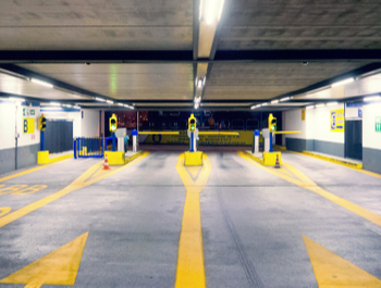
Parking
Parking

Your way to a secure parking space! Benefit from the attractive online parking offers of Gazipaşa-Alanya Airport

Flight Information
Flight Information

Real-time information of arrival and departure flights at Gazipaşa-Alanya Airport

Frequently Asked Questions

No.
Please click on the link below for further information.
Information regarding customs procedures can be found at: www.ticaret.gov.tr
No.
The visa office is located at the transit area on the arrivals floor of the International Terminal before the passport check points open 7/24.

Lost Property Offices

Phone: (242) 582 71 26 – 7 / (242) 582 74 26 – 7

No.
Each airline has different procedures for domestic animals. You must inquire about this with your airline company. Most airlines do not accept birds and rodents into the cabin. These types of animals may travel in the cargo section of the aircraft. There is a restriction on the number of domestic animals accepted into the cabin.
We recommend passengers to be present at the airport 120 minutes (2 hours) prior to their flight.